Eceabat
Eceabat, formerly Maydos (Madytos, Greek: Μάδυτος), is a small town and district of Çanakkale province in the Marmara region of Turkey, located on the eastern shore of the Gelibolu Peninsula, on the Dardanelles Strait. According to the 2010 census, the local population is 9,154 of whom 5,380 live in the town of Eceabat.[3][4] The district covers an area of 468 km2 (181 sq mi),[5] and the town lies at sea level. It is an almost entirely modern town.
Eceabat | |
|---|---|
District | |
 Kilitbahir Castle built by Mehmed II Fatih in 1452 | |
 Location of Eceabat within Turkey. | |
  Eceabat Location of Eceabat  Eceabat Eceabat (Turkey)  Eceabat Eceabat (Europe) | |
| Coordinates: 40°11′N 26°21′E | |
| Country |  Turkey Turkey |
| Region | Marmara |
| Province | Çanakkale |
| Government | |
| • Mayor | Saim Zileli (İyi Party) |
| Area | |
| • District | 468.32 km2 (180.82 sq mi) |
| Elevation | 0 m (0 ft) |
| Population (2012)[2] | |
| • Urban | 5,380 |
| • District | 8,993 |
| • District density | 19/km2 (50/sq mi) |
| Time zone | UTC+2 (EET) |
| • Summer (DST) | UTC+3 (EEST) |
| Postal code | 17xxx |
| Area code | 286 |
| Licence plate | 17 |
| Website | www.eceabat.bel.tr |
Eceabat is the departure point for the annual swim across the Hellespont to Çanakkale on the other side of the Dardanelles Strait.
Eceabat is the nearest town to the World War I Gallipoli Campaign battlefield sites, as well as to the cemeteries and memorials to the more than 120,000 Turkish, British, French, Australia ad New Zealand soldiers killed during the campaign. This has led to its becoming a major tourism centre, especially around 18 March and 15 April (ANZAC Day) when the two different sides of the struggle commemorate their roles in what happened.[6]
Name
Eceabat's name might have originated from the Arabic military term "hijabat" which means the most forward command point from the battlefield. If so, the meaning might explain the change from the original Madytos.
Attractions
Kilisetepe Mound in Eceabat town covers the site of the original Maydos. The Greek Orthodox church that used to stand on it was demolished in 1923.[7]
Kilitbahir Castle, 11km south of Eceabat, is an architectural masterpiece, commissioned by Mehmed II in 1462 after the conquest of Istanbul. Süleyman the Magnificent added the Sarı Küle, a beautiful tower of large cut stones, to the original fortifications. The castle's heart-shaped layout is unique. The smooth rubble walls were not given great importance but the clover-shaped three courtyards of the inner courtyard were still sheltered. The inner castle has seven floors. Bunkers were added to the site during the Gallipoli campaign. There is a small military museum inside the castle. [8]
Ancient Sestos was on the site of the village of Yalova, Eceabat, 4 km from Eceabat. It was established to the south of Akbaş port. Its stones were reused in the building of Kilitbahir Castle.
Seddülbahir Castle was built in 1659 by Mustafa Ağa, the architect of Frenk Ahmed Pasha, during the reign of Mehmed IV.
Bigali Castle is 5 km from Eceabat. Work on it began in 1807 during the reign of Selim III; it was completed during the reign of Mahmud II. Stones taken from the lost city of Sestos were used to build the castle.
Notes
- "Area of regions (including lakes), km²". Regional Statistics Database. Turkish Statistical Institute. 2002. Retrieved 5 March 2013.
- "Population of province/district centers and towns/villages by districts - 2012". Address Based Population Registration System (ABPRS) Database. Turkish Statistical Institute. Retrieved 27 February 2013.
- Statistical Institute
- GeoHive. "Statistical information on Turkey's administrative units". Retrieved 20 April 2009.
- Statoids. "Statistical information on districts of Turkey". Retrieved 20 April 2009.
- "ECEABAT". www.turkeyfromtheinside.com. Retrieved 3 October 2022.
- "ECEABAT". www.turkeyfromtheinside.com. Retrieved 3 October 2022.
- "KİLİTBAHİR". www.turkeyfromtheinside.com. Retrieved 3 October 2022.
References
- Falling Rain Genomics, Inc. "Geographical information on Eceabat, Turkey". Retrieved 19 April 2009.
External links
 Media related to Eceabat at Wikimedia Commons
 Eceabat travel guide from Wikivoyage
- District governor's official website (in Turkish)
- Road map of Eceabat and environs
- Various images of Eceabat, Çanakkale
- Eceabat

Eceabat in Çanakkale Province of Turkey | |||||||||||||||||||||||||||
|---|---|---|---|---|---|---|---|---|---|---|---|---|---|---|---|---|---|---|---|---|---|---|---|---|---|---|---|
| Districts | 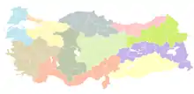 Districts of Çanakkale | ||||||||||||||||||||||||||
| |||||||||||||||||||||||||||
Metropolitan municipalities are bolded. | |||||||||||||||||||||||||||
| Villages of Eceabat District | ||
|---|---|---|
 | ||