Laut Eritrea
Laut Eritrea (Yunani: Ἐρυθρὰ Θάλασσα, Erythra Thalassa, "Laut Merah") adalah nama dalam kartografi kuno untuk perairan yang terletak di antara Tanduk Afrika dan Semenanjung Arab. Nama ini sekarang sudah usang.
| Laut Eritrea بحر اريترا | |
|---|---|
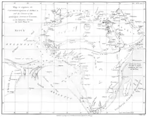 Peta yang menunjukkan Laut Eritrea di sebelah Tanduk Afrika. Dilukis oleh James Rennell, 1799. | |
| Letak | Samudra Hindia barat laut |
| Koordinat | 12°0′N 55°0′E |
| Jenis perairan | Laut |
| Terletak di negara | Yaman, Somalia |
Etimologi
Sebutan ini mungkin berasal dari Trichodesmium erythraeum berwarna merah yang mekar musiman dekat permukaan air.[1]
Pada abad ke-3, Flavius Philostratus membuat komentar ini: "Dan mereka mengatakan bahwa laut yang bernama Erythra atau "merah" tersebut adalah berwarna biru tua, namun demikianlah laut itu dinamakan, seperti yang saya katakan sebelumnya, dari Raja Erythras, yang memberikan namanya sendiri untuk laut yang bersangkutan." [2]
Lihat juga
Referensi
- "Red Sea". Encyclopædia Britannica Online Library Edition. Encyclopædia Britannica. Diakses tanggal 2008-01-14.
- Life of Apollonius of Tyana, Book III, chapter L, Loeb Classical Library
Pranala luar
- The Periplus of the Erythrean sea, containing an account of the navigation of the ancients, from the sea of Suez to the coast of Zanguebar, William Vincent (ed.), 2 voll., London, 1800, vol. 1, vol. 2.
- William H. Schoff, The Periplus of the Erythraean Sea: Travel and Trade in the Indian Ocean by a Merchant of the First Century (New York: Longmans, Green, and Co., 1912), with additional commentary including alternate spellings or translations from Lionel Casson's more recent edition.
This article is issued from Wikipedia. The text is licensed under Creative Commons - Attribution - Sharealike. Additional terms may apply for the media files.