Mughallis
Mughallis (bahasa Arab: مٌغلّس) adalah sebuah desa Arab Palestina yang berjarak 305 kilometer (190 mi) dari barat laut Hebron. Desa tersebut dikosongkan dalam Perang Arab-Israel 1948 antara 9-10 Juli 1948 sebagai bagian dari Operasi An-Far.
Mughallis
مٌغلّس | |
|---|---|
Desa | |
  Mughallis | |
| Koordinat: 31°43′45″N 34°52′57″E | |
| Grid Palestina | 139/126 |
| Entitas geopolitik | Mandat Palestina |
| Subdistrik | Hebron |
| Tanggal pengosongan | 9–10 Juli 1948[1] |
| Luas | |
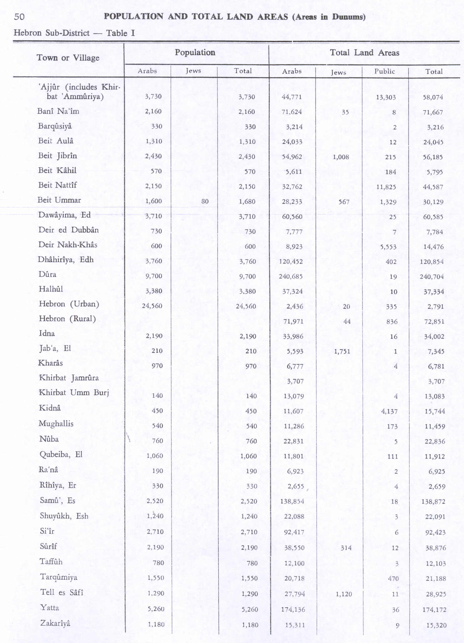
| • Total | 11,459 dunams (11,459 km2 or 4,424 sq mi) |
| Populasi (1945) | |
| • Total | 540[2]][3] |
| Sebab pengosongan | Pengaruh kejatuhan kota terdekat |
| Wilayah saat ini | Gefen[4] |
Referensi

Daftar pustaka
- Barron, J.B., ed. (1923). Palestine: Report and General Abstracts of the Census of 1922. Government of Palestine.
- Conder, C.R.; Kitchener, H.H. (1882). The Survey of Western Palestine: Memoirs of the Topography, Orography, Hydrography, and Archaeology. 2. London: Committee of the Palestine Exploration Fund.
- Department of Statistics (1945). Village Statistics, April, 1945. Government of Palestine.
- Guérin, V. (1869). Description Géographique Historique et Archéologique de la Palestine (dalam bahasa French). 1: Judee, pt. 2. Paris: L'Imprimerie Nationale.
- Hadawi, S. (1970). Village Statistics of 1945: A Classification of Land and Area ownership in Palestine. Palestine Liberation Organization Research Center.
- Hartmann, M. (1883). "Die Ortschaftenliste des Liwa Jerusalem in dem türkischen Staatskalender für Syrien auf das Jahr 1288 der Flucht (1871)". Zeitschrift des Deutschen Palästina-Vereins. 6: 102–149.
- Hütteroth, Wolf-Dieter; Abdulfattah, Kamal (1977). Historical Geography of Palestine, Transjordan and Southern Syria in the Late 16th Century. Erlanger Geographische Arbeiten, Sonderband 5. Erlangen, Germany: Vorstand der Fränkischen Geographischen Gesellschaft. ISBN 3-920405-41-2.
- Khalidi, W. (1992). All That Remains: The Palestinian Villages Occupied and Depopulated by Israel in 1948. Washington D.C.: Institute for Palestine Studies. ISBN 0-88728-224-5. ISBN 0-88728-224-5.
- Mills, E., ed. (1932). Census of Palestine 1931. Population of Villages, Towns and Administrative Areas. Jerusalem: Government of Palestine.
- Morris, B. (2004). The Birth of the Palestinian Refugee Problem Revisited. Cambridge University Press. ISBN 978-0-521-00967-6.
- Palmer, E.H. (1881). The Survey of Western Palestine: Arabic and English Name Lists Collected During the Survey by Lieutenants Conder and Kitchener, R. E. Transliterated and Explained by E.H. Palmer. Committee of the Palestine Exploration Fund.
- Socin, A. (1879). "Alphabetisches Verzeichniss von Ortschaften des Paschalik Jerusalem". Zeitschrift des Deutschen Palästina-Vereins. 2: 135–163.
Pranala luar
- Welcome To Mughallis
- Mughallis, Zochrot
- Oral History and Dual Marginalisation: Palestinian Peasant Women and Nakba Narratives, Abbad Yahya
- Survey of Western Palestine, Map 16: IAA, Wikimedia commons
- Mughallis, from the Khalil Sakakini Cultural Center

This article is issued from Wikipedia. The text is licensed under Creative Commons - Attribution - Sharealike. Additional terms may apply for the media files.