Dumfries and Galloway
A Área de Conselho (ou Council Area) de Dumfries and Galloway (em gaélico escocês, Dùn Phris agus an Gall-Ghaidhealaibh), é uma das 32 novas subdivisões administrativas da Escócia, criada em 1996. Faz fronteira com South Ayrshire e East Ayrshire a noroeste, South Lanarkshire e Scottish Borders a norte e com o Condado de Cumbria ao sul, na Inglaterra. É, também, banhado ao norte pelo Solway Firth e ao leste pela Mar da Irlanda.
| Dumfries and Galloway | |
|---|---|
 Dumfries and Galloway | |
| Geografia | |
| Área Total | 6.426 km² (3ª posição) |
| Categoria | Council Area |
| Sede Administrativa | Dumfries |
| Demografia | |
| População Total (2007) | 309.500 habitantes (5ª posição) |
| Densidade | 175 hab./km² |
| Política | |
| Nome do Conselho | Dumfries and Galloway Council |
| Site | http://www.dumgal.gov.uk/ |
Em 1975, com a abolição dos antigos condados, foi criado a região de Dumfries and Galloway mediante a fusão dos condados de Wigtownshire, Kirkcudbrightshire e Dumfriesshire. A reião foi, por sua vez, subdividida nos distritos de Wigtownshire, Stewartry, Nithsdale and Annandale e Eskdale. Em 1996, as regiões foram abolidas e esta região tornou-se uma unidade autoritária com a mesma área da antia região de mesmo nome.
Geografia
A região de Dumfries and Galloway region é composta por desenas de sub-áreas e registration counties. Do leste para o oeste:
- Wigtownshire
- Rhins of Galloway • Machars
- Kirkcudbrightshire
- Stewartry
- Dumfriesshire
- Nithsdale • Annandale • Eskdale
Cidades e vilarejos
As cidades mais importantes estão em negrito.
- Ae, Airieland, Airds of Kells, Annan, Anwoth, Ardwell
- Beattock, Beeswing, Borgue, Brydekirk
- Caerlaverock, Cairngaan, Cairnryan, Cargenbridge, Carsphairn, Castle Douglas, Castle Kennedy, Clarencefield, Corsock, Creetown
- Dalbeattie, Dalton, Dornock, Drumlanrig, Drummore, Dumfries, Dundrennan, Dunscore
- Eastriggs, Ecclefechan, Eskdalemuir
- Garlieston, Gatehouse of Fleet, Glenluce, Gretna Green, Gretna
- Haugh of Urr, Hoddom
- Johnstonebridge
- Keir, Kippford, Kirkcolm, Kirkcudbright, Kirkpatrick Durham
- Langholm, Lochmaben, Lockerbie
- Middlebie, Millhousebridge, Moffat, Moniaive, Mull of Galloway
- New Abbey, New Galloway, New Luce, Newton Stewart, Newton Wamphray
- Parton, Penpont, Portpatrick
- Robgill Tower, Ringford
- Rigg, Ruthwell
- Sandhead, Sanquhar, St. John's Town of Dalry, Stranraer
- Terregles, Thornhill, Twynholm,Templand
- Unthank
- Wanlockhead, Whithorn, Wigtown
Escolas secundárias
- Annan Academy
- Castle Douglas High School
- Dalbeattie High School
- Douglas Ewart High School, Newton Stewart
- Dalry Secondary School
- Dumfries Academy
- Dumfries High School
- Kirkcudbright Academy
- Langholm Academy
- Lockerbie Academy
- Maxwelltown High School, Dumfries
- Moffat Academy
- Sanquhar Academy
- St Joseph's College
- Stranraer Academy
- Wallace Hall Academy, Thornhill
Lugares de interesse
Imagens de Dumfries and Galloway
 Dalveen Pass.
 Sweetheart Abbey.
 Torre Orchardton.
 Reserva Nacional de Caerlaverock.
 Tongland estação de energia.
 Mull of Galloway.
 Farol do Mull of Galloway.
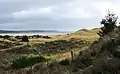 The Machars.
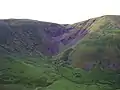 Devil's Beef Tub.
 O porto de Port William.
 Moffat.
 Rio Nith Estuary.
