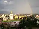
Nagarjun Municipality
Nagarjun is a municipality in Kathmandu District in Bagmati Province of Nepal. It was formed on 2 December 2014 by merging the former VDCs of Bhimdhunga, Ichangu Narayan, Ramkot, Syuchatar and Sitapaila.[1][2] The office of the municipality is located at Harisiddhi, Sitapaila. There are ten wards in the municipality.
Nagarjun Municipality
नागार्जुन नगरपालिका | |
|---|---|
 Statues of five meditating Buddha at Amitabha Monastery | |
  Nagarjun Municipality Location in Nepal  Nagarjun Municipality Nagarjun Municipality (Nepal) | |
| Coordinates: 27°43′57″N 85°15′24″E | |
| Country |  Nepal Nepal |
| Province | Bagmati Province |
| District | Kathmandu |
| Established | December 2014 |
| Government | |
| • Mayor | Mohan Basnet (NC) |
| • Deputy Mayor | Sushila Adhikari (NCP) |
| Area | |
| • Total | 29.8 km2 (11.5 sq mi) |
| Population | |
| • Total | 67,420 |
| • Density | 2,300/km2 (5,900/sq mi) |
| • Ethnicities | |
| Time zone | UTC+5:45 (Nepal Time) |
| Website | www |
Geography
It is surrounded by 13,14, 15 and 16 number wards of Kathmandu Metropolitan City on the east, Dhading District on the west, Tarkeshwar Municipality on the north and Chandragiri Municipality on the south. The area of the municipality is 29.8 square kilometres (11.5 sq mi) and the average altitude is 1,300 metres (4,300 ft) to 2,500 metres (8,200 ft) above sea level.[3]
Population
Nagarjun municipality has a total population of 67,420 (34064 males and, 33356 females) according to 2011 Nepal census. Newar, Bahun, Magar, Sanyasi and Chhetri are the majority ethnic groups in this municipality, most of the population follow Hinduism and Buddhism.[4]
Popular sites
.jpg.webp) Amitabha Monastery, Ramkot
Amitabha Monastery, Ramkot.jpg.webp) Aadeswor Mahadev Temple, a Shiva Temple in Sitapaila
Aadeswor Mahadev Temple, a Shiva Temple in Sitapaila Statues inside Amitabha Monastery, Ramkot
.jpg.webp)
- Ichangu Narayan Temple
- Amitabha Monastery
- Aadeswor Mahadev Temple
- Halchowk Akash Bhairav
- Tarkeshwar Temple
- Badri Narayan Dham
- Sahid Park
- Switzerland Park
- Panch Kanya Temple
- Bhuwaneswori Temple
References
- "Govt announces 61 municipalities". The Kathmandu Post. 3 December 2014. Retrieved 2 December 2014.
- "Govt creates 61 new municipalities". República. 3 Dec 2014. Retrieved 2 Dec 2014.
- "Municipal profiles". web.archive.org. 2014-01-07. Archived from the original on 2014-01-07. Retrieved 2022-10-31.
- "2011 Nepal census (Ward Level)" (PDF). Central Bureau of Statistics. November 2012. Archived from the original (PDF) on November 2013.