Sierra Nevada (AS)
Sierra Nevada (/siˈɛrə n[invalid input: 'ɨ']ˈvɑːdə/ atau /n[invalid input: 'ɨ']ˈvædə/, bahasa Spanyol: [ˈsjera neˈβaða], snowy mountain range[5]) merupakan sebuah barisan pegunungan yang kebanyakan terdapat di California timur. Barisan ini juga dikenal sebagai Sierra.
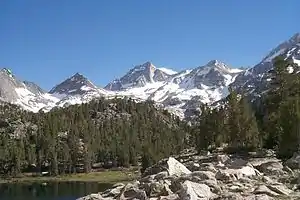
Little Lakes Valley di atas Toms Place, California
| Sierra Nevada | |
|---|---|
 The Sierra's Mills Creek cirque (center) is on the west side of the Sierra Crest, south of Mono Lake (top, blue). | |
| Titik tertinggi | |
| Puncak | Mount Whitney |
| Ketinggian | 14.505 ft (4.421 m) [1] |
| Coordinates | 36°34′43″N 118°17′31″W |
| Dimensi | |
| Panjang | 400 mi (640 km) north-south from Fredonyer Pass to Tehachapi Pass [2] |
| Lebar | 65 mi (105 km) [3] |
| Luas | 24.370 sq mi (63.100 km2) |
| Naming | |
| Etimologi | 1777: Spanish for "snowy mountain range" |
| Nickname | the Sierra, the High Sierra, the Sierras, Range of Light (1894, John Muir)[4] |
| Letak Geografis | |
 | |
| United States | |
| Negara Bagian | California and Nevada |
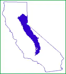
| Range coordinates | 37°44′N 119°34′W |
| Geologi | |
| Periode | Mesozoic |
| Tipe batuan | batholith and igneous |
Referensi
- "Mount Whitney". NGS data sheet. U.S. National Geodetic Survey. http://www.ngs.noaa.gov/cgi-bin/ds_mark.prl?PidBox=GT1811.
- "Sierra Nevada". Ecological Subregions of California. United States Forest Service. Diarsipkan dari versi asli tanggal 2010-12-05. Diakses tanggal 2012-09-16.
- "Sierra Nevada". SummitPost.org. Diakses tanggal 2010-05-29.
- Muir, John (1894). Chapter 1: The Sierra Nevada. The Mountains of California. Diarsipkan dari versi asli tanggal 2010-06-20. Diakses tanggal 2010-05-29. Hapus pranala luar di parameter
|work=(bantuan) - Carlson, Helen S. (1976). Nevada Place Names: A Geographical Dictionary. University of Nevada Press. hlm. 215. ISBN 978-0-87417-094-8.
Sacramento (ibu kota) | |
| Topik |
|
| Region |
|
| Wilayah metro |
|
| County / Kabupaten |
|

Pengawasan otoritas  | |
|---|---|
| Umum | |
| Perpustakaan nasional | |
This article is issued from Wikipedia. The text is licensed under Creative Commons - Attribution - Sharealike. Additional terms may apply for the media files.