Conselho de Praias do Norte
O Conselho de Praias do Norte (Northern Beaches Council) é uma área de governo local localizado em Praias do Norte região de Sydney, no estado de Nova Gales do Sul, Austrália. O Conselho foi formado em 12 de maio de 2016, substituindo os conselhos de Manly, Pittwater e Warringah.[1]
Conselho de Praias do Norte

| País | |
|---|---|
| Departamento | |
| Área |
254 km2 |
| Coordenadas |

| População |
263 554 hab. () |
|---|---|
| Densidade |
1 037,6 hab./km2 () |
| Estatuto |
local government area of New South Wales (d) |
|---|---|
| Presidente | |
| Assembleia deliberante |
Northern Beaches Council (d) |
| Contem as localidades |
Allambie Heights Avalon Balgowlah Balgowlah Heights Bayview Beacon Hill Belrose Bilgola Beach Bilgola Plateau Brookvale Church Point Clareville Clontarf Coasters Retreat Collaroy Collaroy Plateau Cottage Point Cromer Curl Curl Currawong Beach Davidson Dee Why Duffys Forest Elanora Heights Elvina Bay Fairlight Forestville Frenchs Forest Freshwater Great Mackerel Beach Ingleside Killarney Heights Lovett Bay Manly Manly Vale Mona Vale Morning Bay Narrabeen Narraweena Newport North Balgowlah North Curl Curl North Manly North Narrabeen Oxford Falls Palm Beach Queenscliff Seaforth Terrey Hills Warriewood Whale Beach Wheeler Heights |
| Origem do nome | |
|---|---|
| Fundação | |
| Substitui |
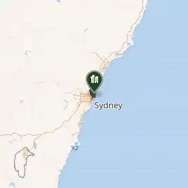
O Conselho compreende uma área de 254 quilômetro quadrados (98 sq mi) e como no 2016 censo tinha uma população estimada de 252 878.[2]
O prefeito inaugural do Conselho Praias do Norte é Cr. Michael Regan, da equipe independente do sua Praias do Norte, que foi eleita em 26 de setembro de 2017.[3]
Subúrbios e localidades
Os seguintes subúrbios estão localizados no Conselho de Praias do norte:[1]
- Allambie Heights
- Avalon Beach
- Balgowlah
- Balgowlah Heights
- Bayview
- Beacon Hill
- Belrose
- Bilgola Beach
- Bilgola Plateau
- Brookvale
- Church Point
- Clareville
- Clontarf
- Coasters Retreat
- Collaroy
- Collaroy Plateau
- Cottage Point
- Cromer
- Curl Curl
- Currawong Beach
- Davidson
- Dee Why
- Duffys Forest
- Elanora Heights
- Elvina Bay
- Fairlight
- Forestville
- Frenchs Forest
- Freshwater
- Great Mackerel Beach
- Ingleside
- Killarney Heights
- Lovett Bay
- Manly
- Manly Vale
- McCarrs Creek
- Mona Vale
- Morning Bay
- Narrabeen
- Narraweena
- Newport
- North Balgowlah
- North Curl Curl
- North Manly
- North Narrabeen
- Oxford Falls
- Palm Beach
- Queenscliff
- Salt Pan Cove
- Scotland Island
- Seaforth
- Terrey Hills
- Warriewood
- Whale Beach
- Wheeler Heights
As seguintes localidades estão localizados no Conselho de Praias do Norte:
- Akuna Bay
- Allambie
- Avalon North
- Bantry Bay
- Barrenjoey
- Bungan Beach
- Bungan Head
- Bungaroo
- Careel Bay
- Careel Head
- Clareville Beach
- Collaroy Beach
- Cromer Heights
- Curl Curl Beach
- Dee Why Beach
- Fishermans Beach (Collaroy)
- Foleys Hill
- Freshwater Beach
- Gooseberry Flat
- Ingleside Heights
- Long Reef Beach (Collaroy)
- Loquat Valley
- Narrabeen Beach
- Narrabeen Peninsula
- North Curl Curl Beach
- North Narrabeen Beach
- Paradise Beach
- Peach Trees
- Sand Point
- Sorlie
- South Warriewood
- Stokes Point
- Taylors Point
- The Basin
- Towlers Bay
- Tumbledown Dick
- Turimetta
- Warriewood Beach
- Wingala
Ver também
- Áreas de governo local de Nova Gales do Sul
- Lista de áreas de governo local em Nova Gales do Sul
Referências
- «Northern Beaches Council». Stronger Councils. Governo de Nova Gales do Sul. 12 de maio de 2016. Consultado em 12 de maio de 2016
- Patterson, Robbie (27 de setembro de 2017). «Michael Regan highlights focus on key infrastructure projects after being elected the northern beaches first mayor». Manly Daily. Consultado em 27 de setembro de 2017
Ligações externas
This article is issued from Wikipedia. The text is licensed under Creative Commons - Attribution - Sharealike. Additional terms may apply for the media files.